How to Convert a PDF or DWG Layout Plan to 3D
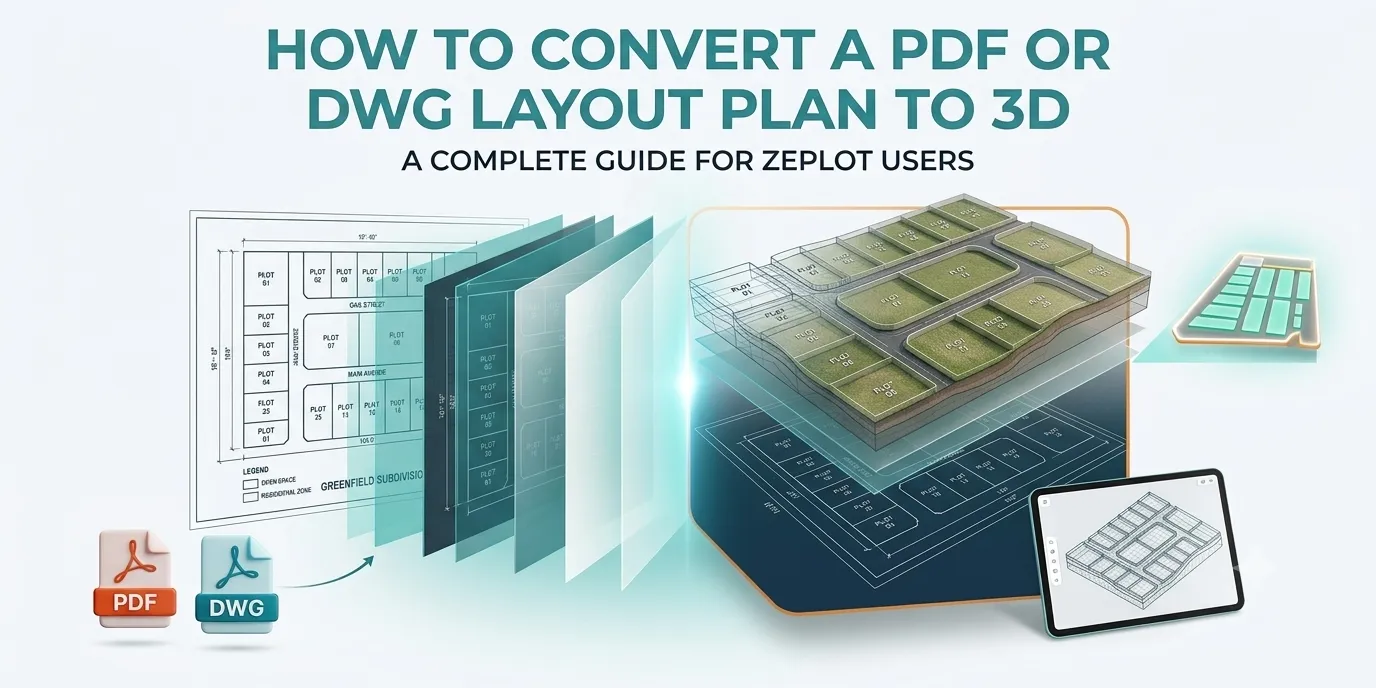
Many developers already have their layout as a PDF or an AutoCAD drawing and want buyers to see it in 3D. There are general tools that convert a DWG to a 3D model, but a plotted layout needs more than extruded lines: every plot must stay a separate, clickable shape with its own number and area, placed on the real site. This guide explains how that conversion works.
Which file should you start from?
| File | What it gives | Notes |
|---|---|---|
| DWG / DXF | Exact geometry and measurements | The best source. DXF can be read directly; DWG is usually exported to DXF or PDF first. |
| Vector PDF | Lines and text from the drawing | Good when exported from CAD. Plot numbers and dimensions stay sharp. |
| Scanned PDF or photo | A picture of the layout | Works if it is clear and straight; plots are traced by hand, so it takes more checking. |
Whatever the format, use the approved layout, so the 3D map matches what buyers will sign for.
Step 1: Collect the project details
- The layout file.
- The site location, so the layout can be placed on the satellite map.
- The current status of each plot: available, booked, on hold or sold.
- Optional: project name, amenities, photos and brochure.
Step 2: Draw every plot as its own shape
Each plot is traced as a separate polygon and linked to its plot number, area and side measurements. Roads, parks and amenity sites become their own shapes too. This is the most important step: it is what makes the map searchable and clickable, rather than a flat picture.
Step 3: Place the layout on the real site
The layout is positioned on the satellite picture, turned to true north and scaled, until the roads on the drawing sit on the roads on the ground. Only the drawing is moved as a whole; plot areas and measurements stay exactly as surveyed.
Step 4: Build the 3D scene
Plots, roads, green spaces and amenity buildings are shown in 3D, with labels for plot numbers and road widths. Buyers can switch between the flat view and the 3D view, zoom, rotate and search for a plot.
Step 5: Check it against the drawing
- Every plot number appears once and matches the drawing.
- Plot areas match the area statement.
- Road widths and amenity sites are labelled correctly.
- The layout sits correctly on the satellite view.
Step 6: Publish one link
The finished map is published on one link with a QR code. From then on, plot status and prices are changed from the admin and the map updates for every buyer, without a new file or a new link.
How long does it take?
With zeplot, a layout with a clean PDF or DXF is usually live within 24 hours of receiving the file. Scanned layouts and very large projects may need more checking. You can upload your layout for an instant check of whether it is usable.
Common problems and how to avoid them
- Plot numbers missing or repeated on the drawing. Fix them in the source file first.
- Layers merged together in CAD, so plots, roads and text are hard to separate. Keep plots on their own layer when exporting.
- An old revision of the layout. Always send the final approved version.
- Blurred scans. A photo taken at an angle or in poor light makes numbers unreadable.
Frequently asked questions
Can a free DWG to 3D converter do this?
General converters turn lines into 3D shapes, but they do not know which shape is a plot, so you cannot tap a plot, see its status or search for it. A plot map needs each plot as its own object.
Can I convert a PDF plan to 3D without the CAD file?
Yes. A clear PDF is enough. The CAD file just makes measurements faster to take.
What happens when the layout changes?
Changes to plot status and prices happen instantly from the admin. A change to the layout itself is redrawn from the new approved drawing. Read more about 3D layout plans.
Want to see your own layout like this?
Get StartedMore from the blog

Interactive Site Plan vs Virtual Tour: Which Sells Plots Better?
Interactive site plans and 360 virtual tours compared for real estate: what each shows, when to use which, and costs.
Read more →
Plot Layout Design Software: Free and Paid Options Compared
Plot layout and site layout software compared: CAD, free and online tools, 3D, and what to use for each job.
Read more →
3D Layout Plan for Plotted Projects: A Complete Guide
What a 3D site plan for plots is, how it differs from a 2D layout, and how to turn your layout PDF into one buyers open on phones.
Read more →